It's April 30, 1960; Do You Know Where You Are?
posted by Pop Tart at
6:56 PM
11 Comments
Links to this post
![]()
![]()
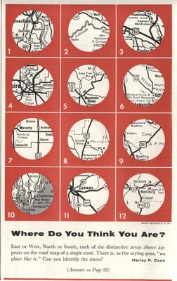
From The Saturday Evening Post, comes the double-dog-dare, "Where Do You Think You Are?"
7/16/08 Update -- With The Answers!
(complete with 1960 state abbreviations, for that full-bodied retro taste)
1. Mass
2. Colo
3. Mo.
4. Wis.
5. Idaho
6. N.J.
7. Iowa
8. Ariz.
9. Va.
10. Me.
11. S.C.
12. Wash.
Looks like Jason was right - congrats, map geek.
Second Place Steve was just 5 minutes off; story of his life, ey.


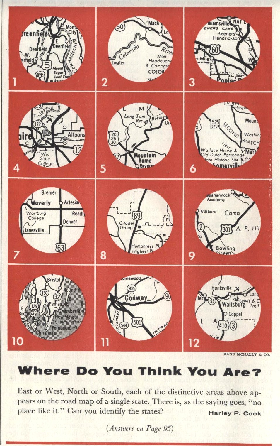
East or West, North or South, each of the distinctive areas above appears on the road map of a single state. There is, as the saying goes, "no place like it." Can you identify the states?Think you know your 1960's maps? (Or perhaps it is more accurate to say 1950's maps...) Maybe you're just a smarty pants. Whatever. Post your (however well-educated) guesses. I'll post the answers later in the week.
Harley P. Cook
7/16/08 Update -- With The Answers!
(complete with 1960 state abbreviations, for that full-bodied retro taste)
1. Mass
2. Colo
3. Mo.
4. Wis.
5. Idaho
6. N.J.
7. Iowa
8. Ariz.
9. Va.
10. Me.
11. S.C.
12. Wash.
Looks like Jason was right - congrats, map geek.
Second Place Steve was just 5 minutes off; story of his life, ey.
Labels: 1950s, 1960s, maps, quiz, vintage magazines